31.1Bicycle Network
Every time I see an adult on a bicycle, I no longer despair for the future of the human race.H. G. Wells, novelist, 1866–1946
This section discusses the general planning elements for a bicycle network, and how it fits within the overall public transport network.
31.1.1Trip Chains
Virtually all trips can be analyzed as a “chain of trips.” The simplest chain has three links: a walking trip to a vehicle, a vehicle ride, and a walking trip to one’s final destination. For those lucky enough to be able to store their bikes in their homes and offices, the journey may consist entirely of one mode: the bike.
The trip-chain concept is of utmost importance when thinking about public transport. All public transport users have to travel from their origin to the public transport stop, and at the end of the trip from the public transport stop to their destination. This means that “access” and “egress” trips are an integral part of public transport travel. These “feed” the transport system, and are referred to as feeder trips. Given its complementary characteristics, cycling is an excellent feeder mode.
An integrated public transport system allows users to ride their bicycles from their home to the nearest public transport station, and then take public transport to their final destination (by leaving their bicycle at the station or taking it with them on the public transport vehicle). When multi-modal connections are well implemented, travel times become similar to or better than those of a private car, especially in big cities with congestion and less provision for parked cars. Above all, travel times improve when public transport enjoys segregated express routes (e.g., in BRT or rail systems), and can travel congestion free. A transport policy that includes as wide a range of multimodal (or intermodal) trip opportunities as possible can increase public transport ridership, while increasing access for all transport users.
Table 31.1Possible Trip-Chain Combinations
| Walk | Bike | Public transport | Drive | Transfer | |
|---|---|---|---|---|---|
| Entire distance | X | X | X | ||
| Partial distance | X | X | X | ||
| To the stop/station/parking | X | X | X | X | |
| At the stop/station/parking | X | X | |||
| From the stop/station/parking | X | X | X | X | |
| Finding parking | X | X |
31.1.1.1Integrating Bicycles into the Trip Chain
The following lists precise points in the trip chain that benefit most from bicycle integration:
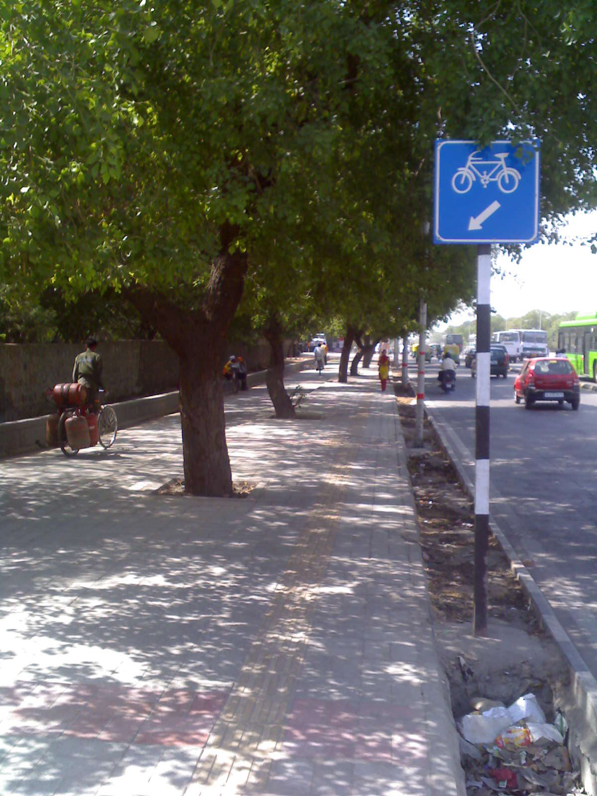
- To/from the public transport station: Bicycles should be available to serve people whose point of origin or final destination is too far from the public transport station for them to complete their trip on foot. In some cities, users keep a second bicycle parked at the egress station, but this is not normally the case, particularly in developing cities. Three services to meet this need include:
- Rental bicycles: Bicycles that are managed by a specific company and are rented and returned to the same location, mostly for tourist purposes;
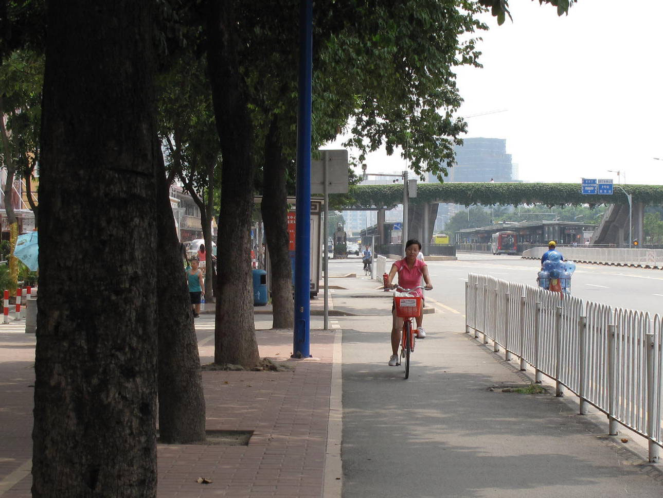
- Shared bicycles: An important form of public transport, shared bicycles allow for trips linked to public transport and increased public transport range and are similar to rental bicycles, but organized on a larger scale. Kiosks or stations are located throughout the city to allow users to circulate shared bicycles. Often rented for short periods of time through a membership system, bike-share serves both tourists and commuters;
- Bicycle taxis (pedicabs): Three-wheeled human-powered vehicles that operate as feeders to public transport;
- At the public transport station:
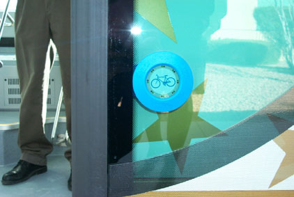
- Bike parking: The provision of ample, secure bicycle parking facilities near or in public transport stations;
- Bike stations: Enhanced bicycle facilities in key locations with various services, used as a multimodal transfer station. Services may include key card access bike parking, locker rooms, showers, rental, and retail facilities;
- During the public transport ride:
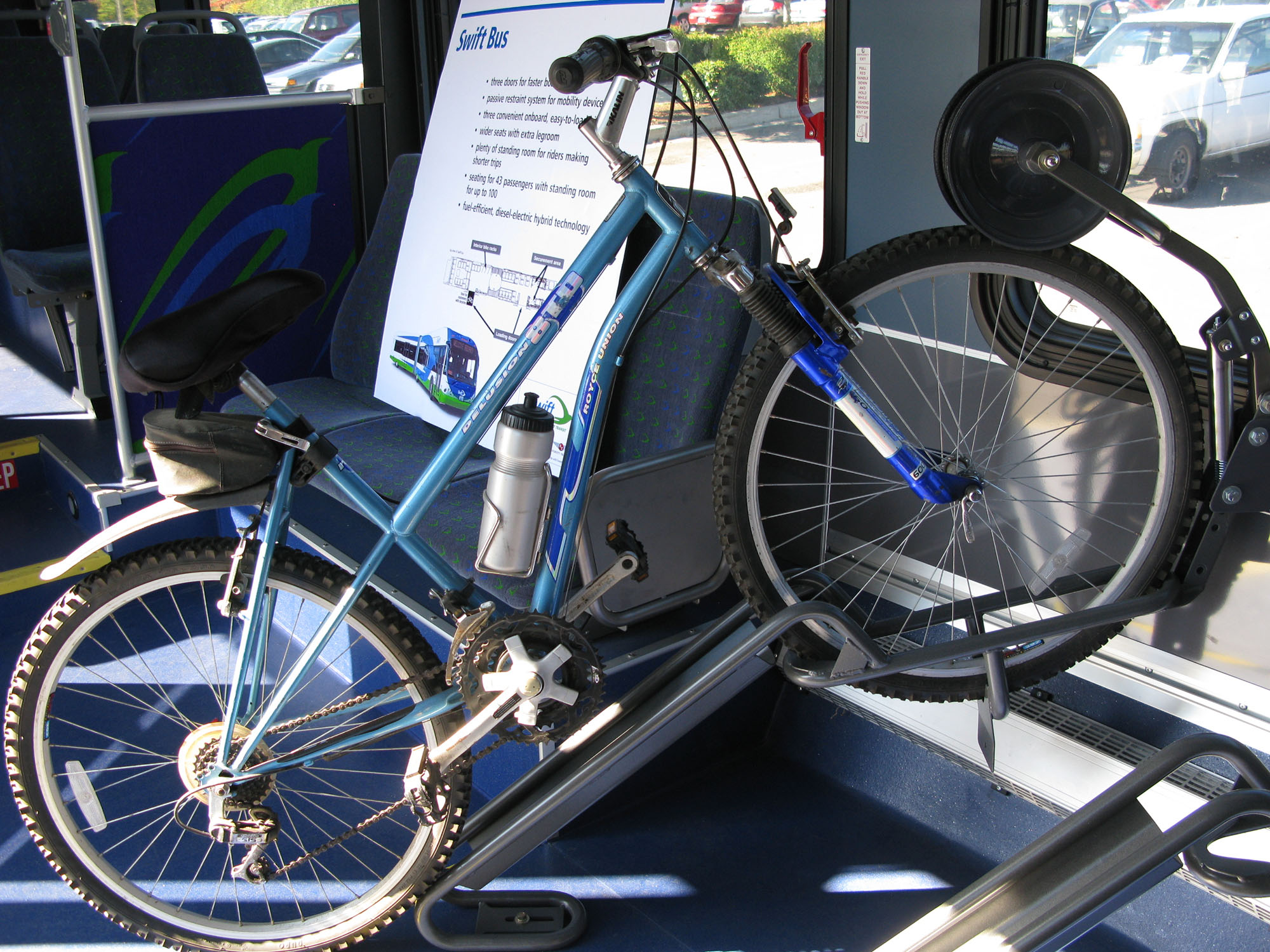
- Bikes on buses: Provision of bicycle racks on the front of or within buses, where public transport relies mostly on bus-based systems;
- Bikes on rail systems: Provision of space and permission to enter rail vehicles in specific times and locations, for large cities with rail-based systems.
31.1.1.2Minimizing Delay and Transfers
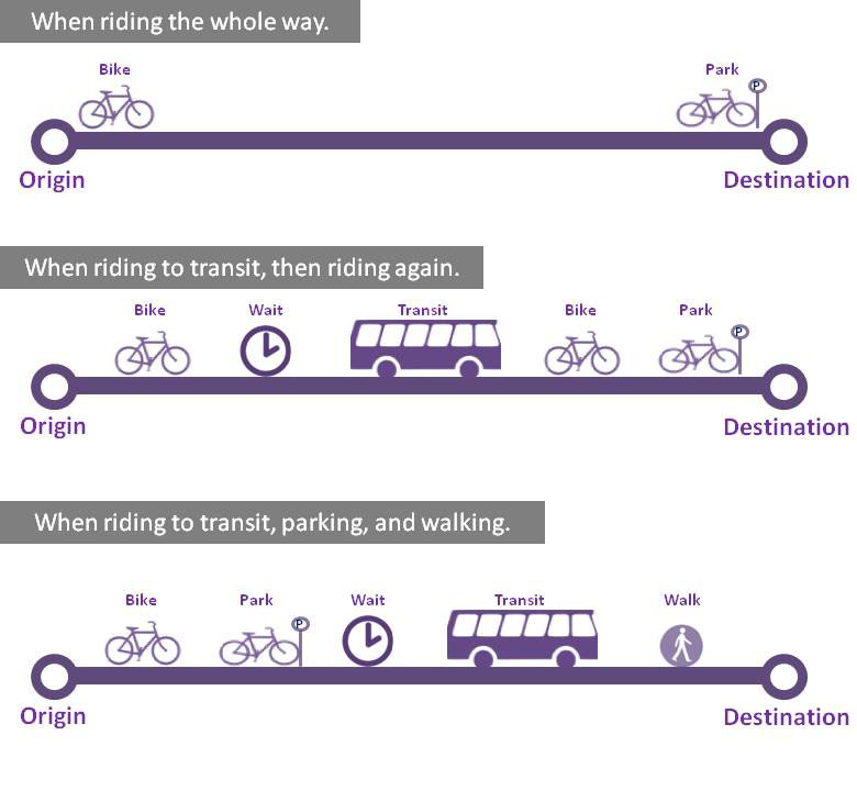
When deciding whether and how to make a trip, people make a number of calculations based on time, ease, price, and familiarity. Delays and transfers increase trip time. Predicting and calculating these points of delay is an important part of structuring an overall journey, whether by the consumer or public transport operator. The critical element usually is the amount of delay at each transfer. If the public transport service is very frequent, wait time will be minimized. If finding bike parking is time-consuming, then the transfer can be longer. As shown in the graphic below, the time to ride a bike from origin to destination might be equal to the same journey involving transfers, especially for short trips.
31.1.1.3The Bicycle’s Part in Modal Integration
The success of any public transport system depends on modal integration. A driving network extends from one’s origin (garage) to one’s destination (parking) with an entire complement of integrated roadways: driveways, access lanes, highways, and so on. Likewise, a public transport network should extend from origin to destination. The bicycle can be an integral part in this network as it extends and augments the public transport network; the ability to use a bicycle can be the deciding factor in whether one takes public transport or chooses to drive alone.
31.1.2Catchment Area
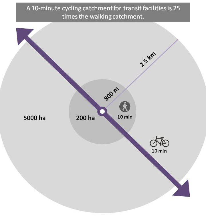
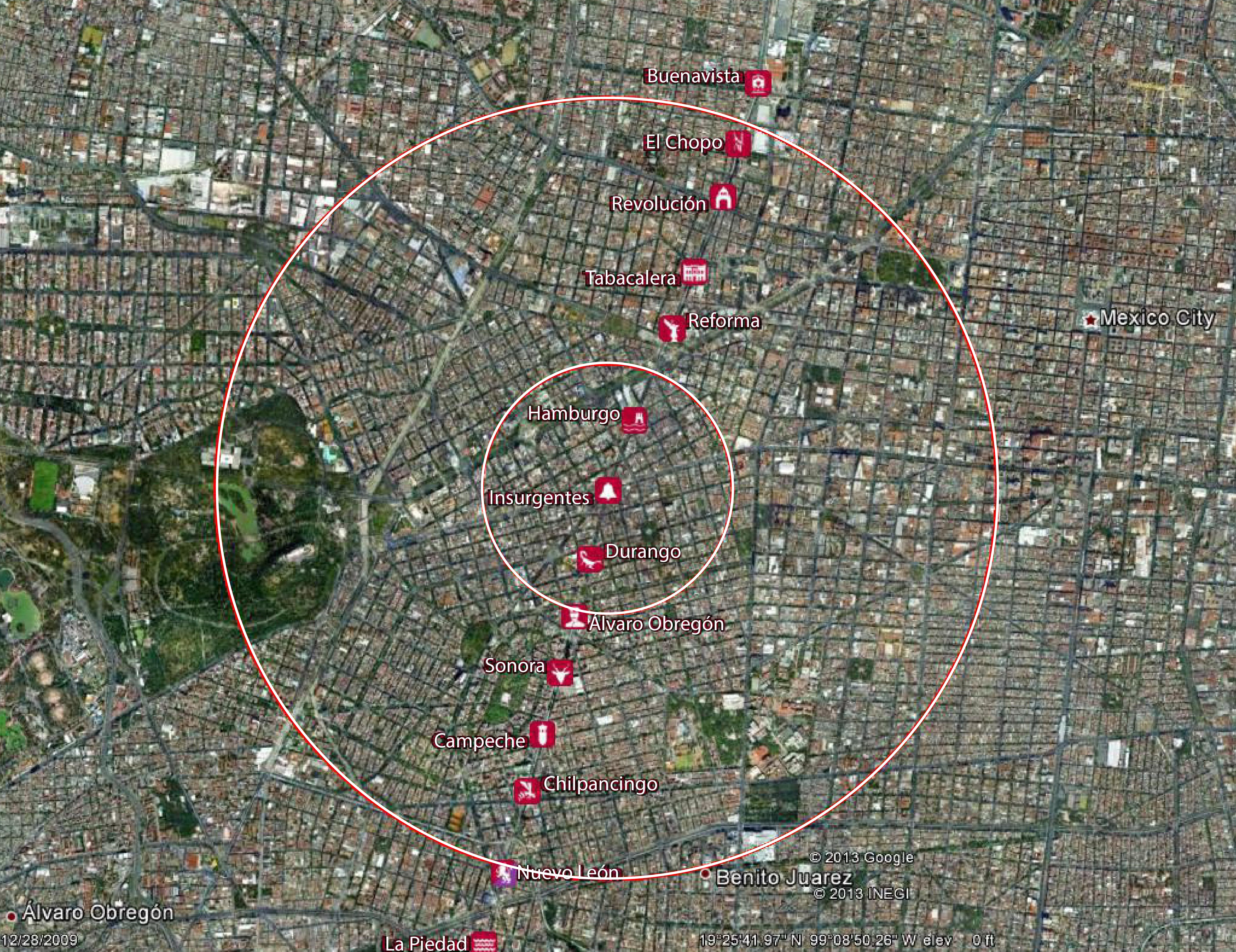
Cycling exponentially increases the catchment area of a BRT station. As shown in Figure 31.4, one can walk about 800 meters in 10 minutes, assuming a 4.8-kph pace. Ten minutes is generally used as the amount of time that one will travel to access high-quality public transport (BRT, metro, ferry). Cycling at 15 kilometers per hour (kph) yields a range of 2.5 kilometers in the same amount of time. Fifteen kph is known as a “no sweat” pace—a speed that will allow you to arrive dry. While the cycling distance is just over three times that of walking, the catchment area is twenty-five times greater. Figure 31.2 applies these catchment areas to the Insurgentes BRT line in Mexico City.
The bicycle-catchment area expands the longer patrons are willing to ride to the BRT station. This is important in lower-density areas, or in areas constrained by geography. A catchment area based on a 60-minute ride is 15 kilometers in radius. This could cover a large part of an urban area. Thirty minutes (7.5-kilometer radius) is the general limit for a normal catchment area.
31.1.2.1Integrating Bicycles with BRT
The benefits of integrating bicycles into the BRT system include:
- Door-to-door service, competitive with private vehicles;
- Larger station-catchment areas (see Section 31.1.2), which increase ridership potential;
- Low-cost system expansion (bicycles used instead of feeder buses);
- Reduced pressure on congested roads and auto parking (trips shift to bicycle);
- Less delay, because patrons do not need to wait for feeder buses.
Key initiatives to improve cycling-BRT integration include:
- Seamless bicycle-route connections to BRT stations;
- Smooth transfers between bicycles and the BRT system;
- Secure parking facilities for bicycles at BRT stations;
- Bike rentals or public bicycle services;
- Pedicabs (bicycle taxis).
31.1.3Using Bikes to Augment BRT
Typically, bicycles have been used to expand the reach of BRT; however, bicycles can also be used to augment service. For example, if BRT station spacing is based on a cycling catchment area (2.5 kilometers) instead of a walking catchment area (800 meters), fewer stations or skip-stop service are required. With fewer stops, travel time on the vehicle is reduced. Those fewer stations can be more highly developed, with bike parking and so forth. This scenario has been proposed in the Netherlands, where the highly developed bicycle infrastructure makes it feasible.
Bicycles can augment BRT via recreational trips on the weekends and during off-peak hours. Often the system will have excess capacity during these times, which can be used to travel to the outskirts of the city and ride a bike in the country, for example.
Bicycles can help distribute journeys more evenly throughout the system. For instance, patrons arriving by foot typically walk to the nearest station, even though it may be small, crowded, or not an express stop. By bike, one has a greater choice of stations. Thus, one can choose an express stop, a station on a different line (thereby avoiding a transfer), or a station that is less crowded. This may relieve pressure on overloaded segments and add customers on underused stretches.
31.1.4Complementary BRT and Bicycle Networks
Traditionally, public transport and bicycle networks have been developed and operated separately. In many cases, they were seen as competitors; public transport operators feared that cycling would steal patrons, and vice versa. This is parallel to the animosity between public transport and driving systems.
Some of the more recently successful BRT systems have taken a different approach. They see cycling as complementary and have sought to develop complementary systems. The basic idea is: It is not possible to provide high-quality public transport service to every part of the city, so bicycles fill in the gaps. Thus, the combination of a BRT system with a bike-lane network can do much to provide citywide mobility and improved access for users. For example, Bogotá is home to Latin America’s largest bicycle network with some 320 kilometers of dedicated bike lanes. Ultimately, if one can move throughout a city without a car, then one will not need a car.
Techniques to merge BRT and bicycle systems include:
- Place bicycle facilities on higher-volume, higher-speed roads that lead to the BRT corridor. This will “collect” cyclists and deposit them at the BRT stations;
- Locate BRT stations along existing high-usage bicycle routes, such as greenways. This will allow cyclists to ride to the stations, or ride to a different BRT line;
- Upgrade the cycling infrastructure within 2.5 kilometers of BRT stations (discussed in Section 31.3.1 of this chapter).
31.1.5Bicycles Onboard BRT
The viability of permitting bicycles to be brought on board the BRT vehicle depends on the level of crowding in the system, which is discussed in more detail in Chapter 7: Capacity and Speed. In general, folding bikes should be allowed on board at all times, in much the same way that luggage is. It may be prudent to require a bag, or that the bike be placed in a luggage hold. Some BRT systems, such as AC Transit serving the East Bay of California, USA, and C-TRAN in Vancouver, Canada, permit bicycles to be brought on board during nonpeak hours. There might be a requirement to board only certain cars (the first or last) or through certain doors. Some systems require a permit or extra fee; however, if the intention is to encourage cycling this might be counter-productive. Most important, the requirements for bikes on board need to be clear and consistent. For example, if the number of bikes on each vehicle is limited, a cyclist runs the risk of being denied entry, which leads to travel delays. Uncertainty tempers use.