23.3Roadway Geometric Design
A common mistake that people make when trying to design something completely foolproof is to underestimate the ingenuity of complete fools.Douglas Adams, novelist, 1952–2001
There are various ways of configuring the roadway to accommodate a BRT system. Depending on features such as station location, non-motorized transit infrastructure, intersection treatment, etc., the road cross section will have a different configuration. Cross-section design is covered in depth in Chapter 22: Roadway and Station Configuration. This section will focus on changes in the design of the right-of-way that implementing a BRT system might require.
23.3.1Road Widening
Road widening often involves appropriating land surrounding the roadway. The expropriation of land and buildings can be logistically complex and incur political and community opposition. Therefore, the process of land appropriation for the BRT system should be transparent, with extensive community outreach throughout. Land appropriation should be done carefully, taking into consideration the surrounding context and community.
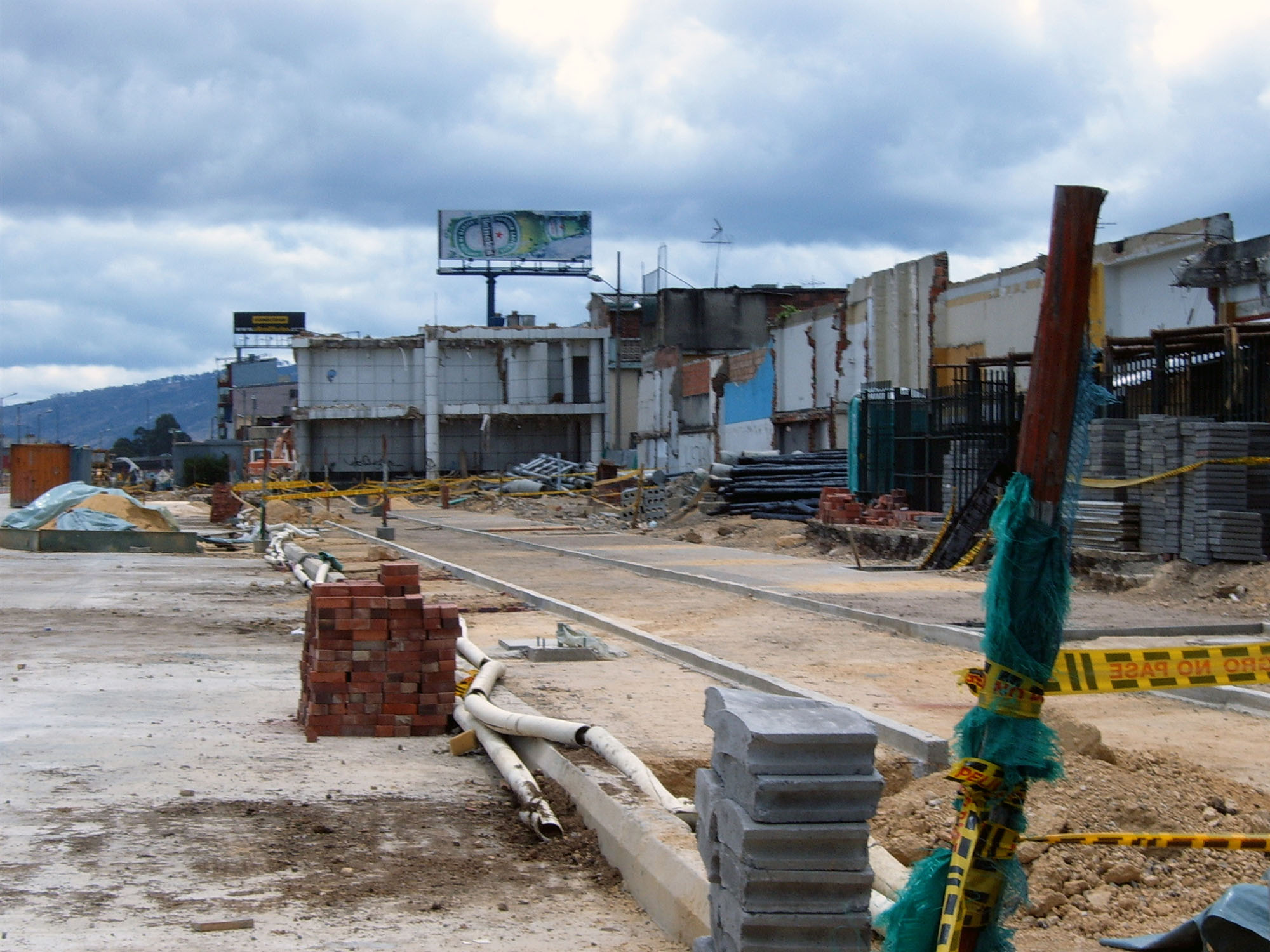
Road widening and land appropriation can also dramatically drive up the costs of the BRT system. Phase II of the Bogotá TransMilenio system has seen extensive road widening and property acquisition along its Norte-Quito-Sur corridor (Figure 23.4). While the existing roadway was actually sufficiently wide for both BRT and mixed traffic lanes, the municipality wished to retain the same number of mixed-traffic lanes after the BRT system went into operation. However, the amount of expenditure on land acquisition has pushed up the corridor’s cost considerably. Phase II of TransMilenio represents a near tripling of costs over the system’s Phase I.
Selective land purchases in bottleneck points away from the central districts are more affordable and there are likely to be fewer conflicts with historical buildings and infrastructure. In particular, areas with undeveloped land, parking lots, derelict buildings, and/or illegal encroachments are clearly more cost-effective acquisition targets than other areas.
However, land cost should not be the only criteria when making land acquisition decisions. If land value is the only deciding factor, then road widening will tend to impact lower-income groups more adversely than others. While it may be economically optimal to widen roads through a poor neighborhood when building a BRT system, mechanisms for compensating poor families with only informal claims to their land will often be weak. The forced relocation of such families will cause severe hardships that should be avoided. Thus, some social criteria should also be included in any decision making on land acquisition or property expropriation.
23.3.2Horizontal and Vertical Alignment
Once the cross section for each section of the route has been fixed, the horizontal alignment of the roadway can be prepared. The horizontal alignment is essentially the layout of the roadway, including general traffic lanes, BRT lanes, BRT stations, intersections, NMT facilities, and landscaping zones.
Once finalized, the vertical alignment can be designed. Vertical alignment is both the slope and the shape of the roadbed and the matching of the station platform to the vehicle’s height to allow for at-level boarding. The vertical alignment depends on the roadway-design speed, the need for superelevation, and the minimum crest and sag curves. Superelevation is usually required on roads with high speeds and tight corners. This rarely occurs on BRT corridors and those type of conditions are usually discouraged for BRT operations.
At median stations, where vehicles dock on either side of the platforms, care needs to be taken to have the busway lanes at similar heights to avoid steps or sloping floors in the station. BRT corridors are often well-developed urban corridors, and hence the vertical alignment design need to ensure that the proposed roadworks tie in with the surrounding urban environment, that is, driveways from properties adjacent to the corridor must tie into the general traffic lanes at acceptable gradients. The drainage of the roadway is endured horizontally through the provision of a cross fall on the roadway, toward stormwater inlets and pipes or a surface channel system. Longitudinally, the route should also be designed to drain surface water to low spots along the route where this water can be collected and introduced to the stormwater system.
23.3.3Stormwater and Drainage
The street environment is often far more complicated than the surface would indicate. The street is the principal conduit of many critical city services, including water supply, drainage, sewer lines, gas lines, and electricity lines. Since BRT systems typically operate on the principal corridors of a city, there is likely to be a concentration of city infrastructure alongside and beneath the busways.
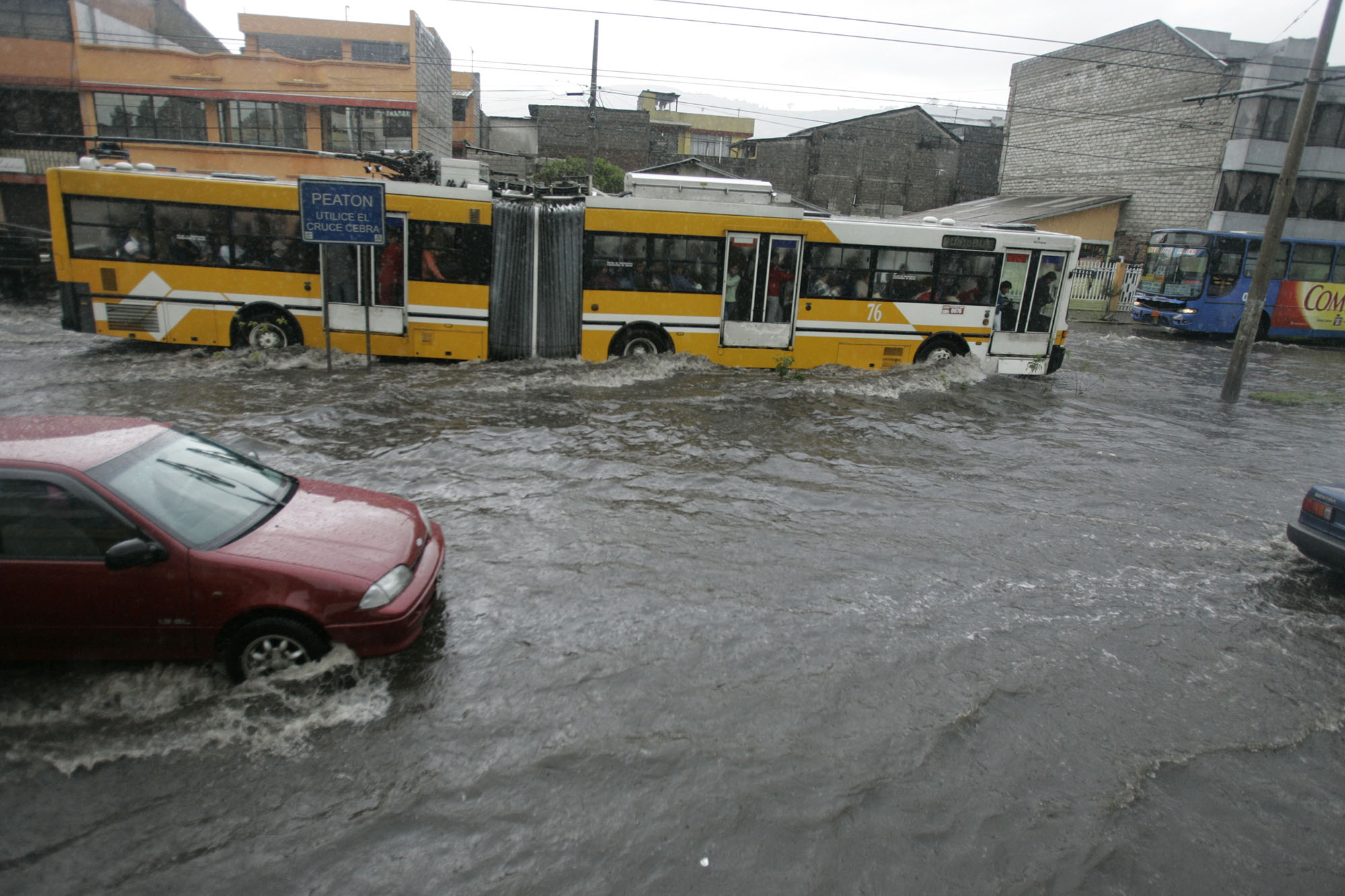
Consultation of city infrastructure maps can determine the extent to which the new BRT system may affect these other services. The construction process must take care to not disrupt or harm the water and drainage lines. If a new surface material is applied for the BRT lane, then water drainage should be explicitly considered in the design process. Concrete busways and painted busways may be less permeable than the previous surface materials. Worst-case storm scenarios should be tested in terms of water buildup. If possible, green stormwater infrastructure should be integrated into the busway, adjoining medians, and sidewalks as both transportation and water management infrastructure are interconnected. If designed properly, green stormwater infrastructure such as permeable pavement, infiltration basins, and rain gardens among others, can mitigate local flooding (Figure 23.5) where there are depressions in the road by allowing water to infiltrate into the ground, rather than collect and puddle on impervious pavement.
23.3.4Impact on Existing Utilities
It is highly likely that the proposed BRT corridor layout will have some impact on existing utilities. The impacted utilities need to be identified and consultation needs to be held with the relevant utility authorities to establish whether the utilities can either be left and protected or need to be moved (and at what cost). Any utilities falling under the busway lanes should be moved, especially if a concrete pavement is being considered. This is also a chance to upgrade these services.
The mitigation of utility impacts can often be the largest contributor to construction delays and construction cost variations. The detailed design of the underground utility mitigations should be done using the best information, which may involve engaging a services contractor prior to the main roadworks contract who can identify the exact location of underground utilities and move or protect them as required.
23.3.5Intersection Design Considerations
The optimum layout and traffic control of intersections is discussed in detail in Chapter 24: Intersections and Signal Control. From a roadway-design perspective, the intersection poses a few interesting design considerations as follows:
- At intersections, major utility runs from side roads converge on the main route and cross it. Rather than have these services buried under concrete BRT lanes, it may be more appropriate to utilize a flexible pavement such as an asphalt surface in the intersection area (area bounded by the pedestrian crossing lines), which can be more easily dug up should utility repairs be required;
- The travel path of the BRT vehicles through the intersection area may need to be strengthened to accommodate the higher-axle loads;
- Pedestrians and cyclists will need to cross the route at intersections, and care must be taken when designing the intersection to ensure that sight lines are not obscured. Sight lines to traffic signals at signalized intersections should be assessed, especially at overpasses.
23.3.6Station Design Considerations
Station placement and design should be a key consideration in the roadway design. Passengers need to feel safe in stations, especially those placed on the median of busy arterials with large public transport vehicles moving past them at high speeds and great frequency. The optimum design will be the one that addresses this issue the best, and where customer convenience is maximized. For details on the different possibilities for station design and placement, see Chapter 25: Stations and Terminals.