6.8Creating New Routes and Combining Old Routes
The path is the goal.Mahatma Gandhi, political and spiritual leader, 1847–1948
There are two fairly typical problems of existing public transport routing that emerge for historical reasons. One problem is that a traditional public transport market may have routes that run along a major road and then terminate at a terminal in the middle of the city, where at some time in the past, a terminal was built, or a minibus taxi rank was created. Often, however, there are many customers who are not going anywhere near the downtown terminal, but to some point beyond it. As such, these traditional routes may force a majority of customers to have to transfer and leave a lot of buses needlessly idling downtown. In such conditions, routes that continue through the CBD for some distance should be considered. In other words, this is the opposite problem of the one addressed in subsection Shortened Routes of Section 6.7.2 above where a route needlessly continued too far, and an early return would have been more efficient. In this case, the route was artificially severed midway for historical reasons. In both cases, the approach to a solution should be similar.
Another typical situation that emerges is that bus routes in cities are organized along a fixed grid pattern. These service patterns also emerged historically for ease of customer network legibility. These grid network patterns also have the advantage of allowing for a lot of directional flexibility with only one transfer. This sort of service plan is common in cities in the United States, where for decades each bus service will tend to ply up and down one specific street in a grid. This is a reasonable service pattern if little else is known about the pattern of trip origins and destinations, or if trip patterns are randomly distributed across the grid. In most cases, where there is a grid, many people are transferring at least once and possibly twice to reach their destination. As there is delay involved in the transfer, if a majority of people are all headed in a single direction that requires a transfer (say, toward downtown), it may make more sense to offer a service that turns the corner rather than just running straight up and down a single arterial and forcing a majority of customers to transfer.
When a BRT corridor is introduced into a grid, one service on a particular street is suddenly much faster than services on alternative streets. If the speed improvement is significant, it may well pull a lot of demand off of bus services on parallel streets, particularly for longer distance trips, capturing demand that otherwise would have been distributed to several stops. In this case, offering some services between popular trip origins and destinations that turn onto the BRT corridor and off the BRT corridor could prove to be advantageous by avoiding the transfer penalty on as many customers as possible.
An example of this can be seen from the BRT service planning for Ashland Avenue in Chicago. The bus routes in Chicago mainly run north and south up the major arterials, or east and west on crosstown streets. The city plans to build Gold or Silver-standard BRT infrastructure through both the Central Loop downtown (Washington and Madison Streets) and along Ashland Avenue. One existing non-BRT bus route (#20) runs east-west connecting Ashland and points west to the Central Loop. Another bus route (#9) runs north-south on Ashland Avenue. The demand on Ashland from Route #9 alone came nowhere near to saturating the planned BRT corridor, so tests were run to see if there would be any benefit in pulling additional demand onto Ashland.
In this case, the service planning team had boarding and alighting data on all the relevant bus routes that interacted with the two corridors, and transfer survey data from all the relevant transfer points. The team mapped the transfer volumes to give a first indication of where customers might be transferring, and did further transfer surveys in those locations. Using simple probability to predict how many customers are likely to transfer from one bus route to the next, the team constructed a corridor-specific origin destination (OD) matrix to test the likely demand and time savings of a few alternative additional services.
They ended up testing the demand levels, and costs and benefits of several alternative routes:
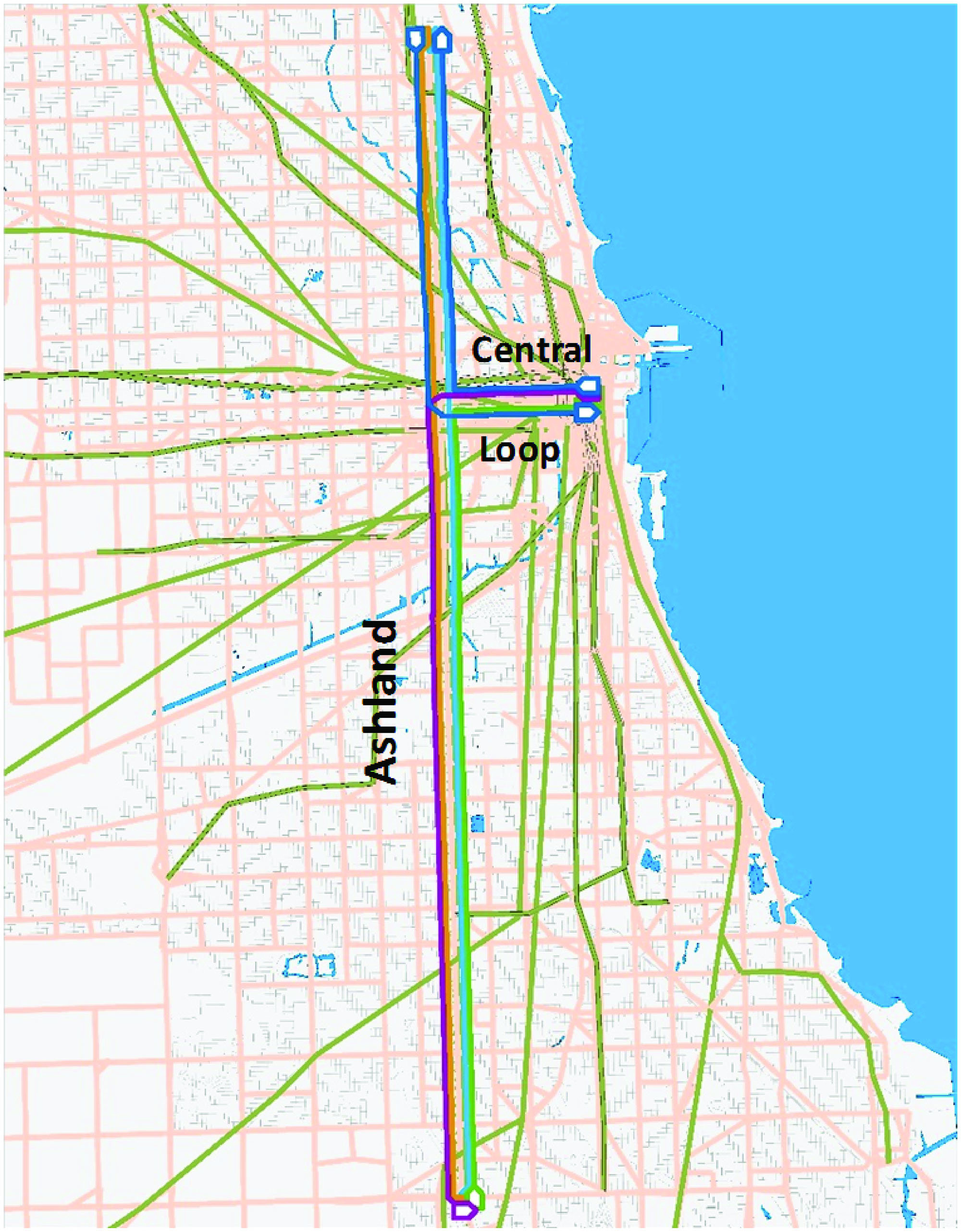
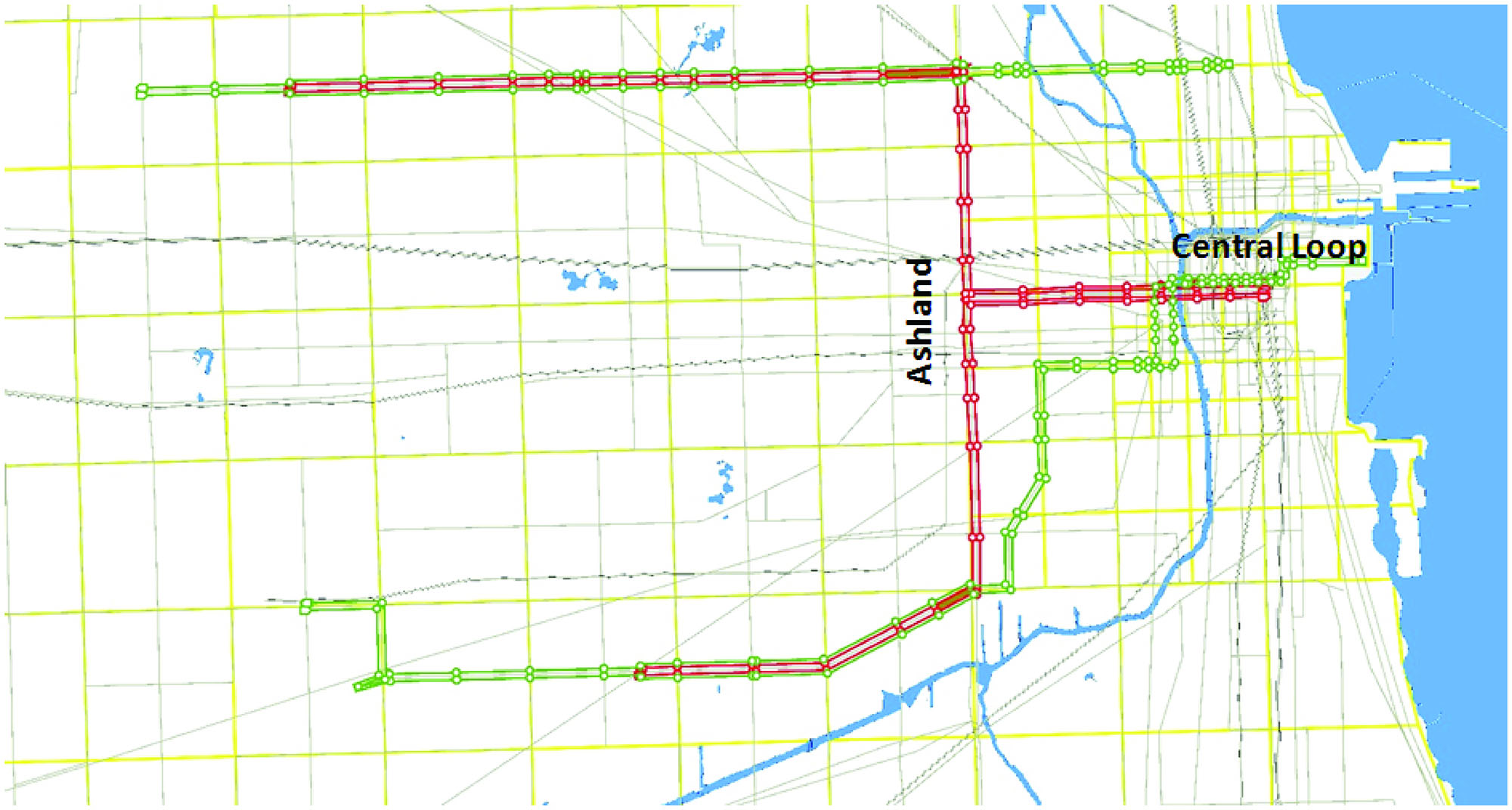
In addition to recommending a BRT service to replace Route #9 up and down Ashland, a southern “L” shaped route was recommended connecting to the Central Loop BRT link, a northern “L” shaped route connecting to the Central Loop BRT, and two “S” shaped routes, coming from the west, turning onto Ashland for a stretch, and then turning again into the Central Loop, as shown above.
Table 6.54Recommended Frequency per Route
| Scenario | Baseline | Standard BRT Route | L Shaped Routes | L and S Shaped Routes |
|---|---|---|---|---|
| Local Route | 6.5 | 2 | 1 | 1 |
| BRT 1 | 0 | 10 | 4 | 4 |
| LN | 0 | 0 | 6 | 5 |
| NS | 0 | 0 | 5 | 4 |
| SN | 0 | 0 | 0 | 4 |
| SS | 0 | 0 | 0 | 4 |
| SE | 0 | 0 | 0 | 0 |
In this case, with the construction of the BRT corridor, the introduction of L- and S- shaped routes that better corresponded to the travel patterns of most people would bring significant user benefits. Total travel time would be reduced for some customers because of increased speeds along the BRT corridor. Some customers would benefit because they would avoid the time previously consumed by transferring either to a bus or a rail line. While the frequency per route drops, because most customers can choose either the direct route or the L-shaped route, the customers who benefit from the inclusion of the new routes outweigh the additional waiting times for a few customers.
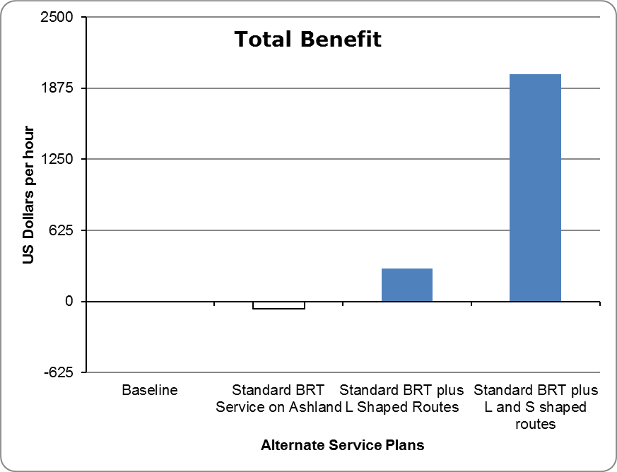
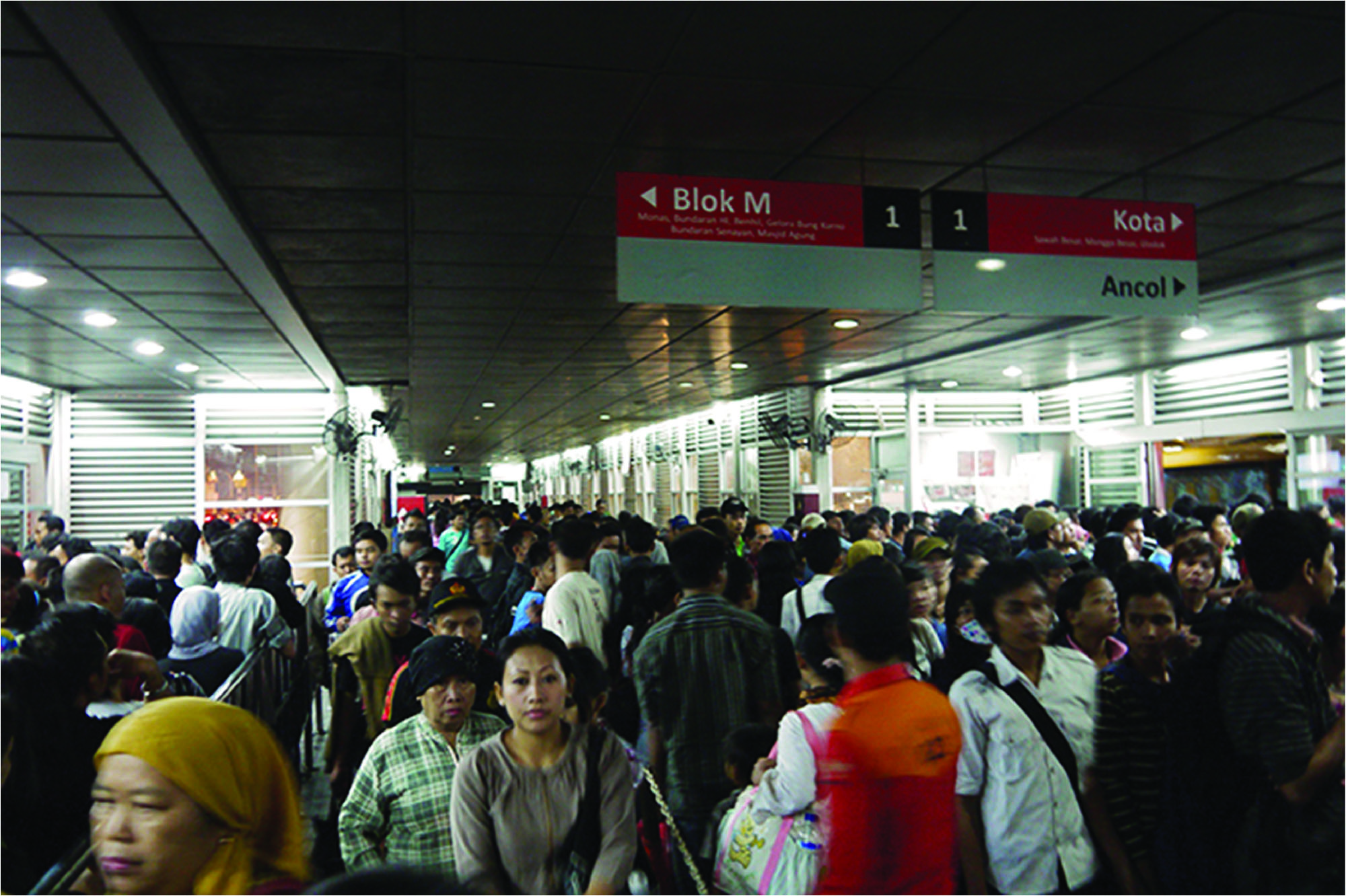
These benefits are significantly greater in high-demand scenarios, where reducing the frequency per route is generally beneficial, and they are marginal in lower demand scenarios. Another service-planning problem that has emerged in some of the larger BRT networks is the lack of inter-corridor routes. This problem tends to manifest itself most acutely in trunk-only or trunk-and-feeder systems. Mexico City, Teheran, and Jakarta all initially developed trunk-only services. These systems all had BRT corridors with very simple services that operated only one local service up and down each BRT trunk corridor. This resulted in crush transfer loads at critical transit points in the BRT network. The worst example of this, which persists, is the overcrowding at the Harmony station in Jakarta. Similar crush loads are observed at the key transfer points in Teheran. Much of this overcrowding has already been mitigated in Mexico City and Jakarta by simply adding a route that travels between one corridor and the next, avoiding the need for a substantial portion of the customers to transfer.
If the original BRT system was developed with “direct” BRT services with a reasonably optimal service plan, this problem would be unlikely.
If the corridor selection process outlined in Chapter 5: Corridor and Network Development is followed, the first BRT corridor is the corridor with the highest vehicle demand and the slowest speeds. If this corridor is given services that operate on and off the BRT trunk corridor, then chances are that the second corridor will simply be an infrastructure upgrade along one or more of these services that already use the first BRT corridor. Even if the original BRT system is a trunk-and-feeder system, it is usually no problem to introduce inter-corridor routes within the trunk system.
Bogotá’s TransMilenio system, despite being a trunk-and-feeder system, has an extensive variety of inter-corridor routes. Customers at a single station may have as many as ten different routes from which to choose, including local and limited-stop services.